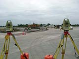
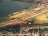
Graph Survey Partnership is specialists in the field of Topographical Surveys for all purposes, regardless of the size of project. Using the very latest reflectorless Robotic Total Stations and Trimble GPS technology coupled with bespoke survey software including LSS, Terramodel and NRG the company is able to produce extremely accurate survey results for Designers, Architects and Civil Engineers.
 |
 |
 |
The results are analysed and then presented in digital 3D format or conventional drawings according to clients preferences. The data can also be exported to any user defined format to suit the various needs of individual clients. An additional feature of this type of service is the ability to provide a volumetric survey which enables the specific analysis of excavated spoil - this measurement is essential to assist developers in associated costings and disposal techniques
Graph Survey Partnership provide a full range of services including...
|
|
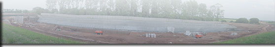
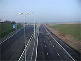
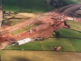
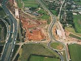
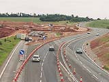
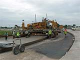
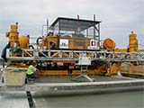
Graph Survey Partnership is specialists in bulk earthworks and roadworks. Whilst there is no lower limit to the size of contracts undertaken in this field it is worth mentioning that during the development of the M6 Toll Motorway the company was responsible for surveying the relocating of a massive 12 million cubic metres of excavated materials.
 |
 |
 |
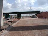
The company are highly experienced in Engineering/Construction Surveys whatever the size of development. This type of survey is carried out after the Topographical Survey has been completed. Although the company provides a full service from start to finish they are more than willing to get involved at this stage, regardless of who carried out the initial Topographical Survey.
This type of survey involves checking details obtained from initial surveys followed by a design analysis stage. The company will then be involved in the setting out of construction projects, buildings, road layouts etc. This may involve mapping out using GPS systems. In this field an overall approach is taken with technical control of each job allowing the planning of buildings, access, road schemes, drainage as well as quantifying materials required.
 |
 |
 |
Whatever your requirements from single surveys of small land areas to a fully integrated survey scheme for major civil engineering contracts Graph Survey Partnership are able to assist. - Now visit the contact page for all contact details.